Monday, February 1, 2010

What Was I Thinking?

Devil's Punchbowl
4,740' elevation
Burkhart Trail


Saturday, January 23
Fail


The sciatica and neuropathy I've been suffering in my legs has not improved; so I thought I'd take a little walk on the Burkhart Trail, from the Devil's Punchbowl end, to see if I could work it out. What was I thinking? We arrived to find snow at that elevation and the parking lot an utter MESS. The wild animals were out of control (and by wild animals I mean the homo sapiens). I stayed only long enough to take a couple shots from the vista and help push a friend out of the parking lot. Poor Ranger Boy! What an awful day with the human side of the job. We made our escape and figured we'd come back another time!

As usual, click on any picture to see the larger version!

From the vista point.


Monday, January 25
A Short Walk
[200' (up and back down) elevation change]


I'm in too much pain; I GOTTA do SOMETHING! So late Monday afternoon, we headed back up to the Punchbowl. This time, the place was blissfully deserted but for the rangers and three people.

DS and I took a little walk up the Burkhart trail, but not terribly far. The altimeter showed we had gained 200 ft elevation before we turned around to beat the dark. The manzanitas up there were HUGE and fairly lush.


Today's vista shot.


And if you see my reflection in the snow-covered hills...


Burkhart Trail signpost in the snow.


I think the photos on this blog have probably established
I really like the color and texture of manzanita bark!


Looking back at Punchbowl Creek canyon rocks.


Big manzanitas up here!


It was sunset as we were leaving; I snapped this shot from a road west of the Punchbowl looking back southEAST at the setting sun reflected in the snow on the surrounding mountain peaks.


Life is still good, pain and all...

Saturday, January 9, 2010

Our Local Superbowl

Friday, January 8, 2010

Devil's Punchbowl
4,740' elevation
1 mi loop trail [300' (down and back up) elevation change]


Do you believe it's possible to love a place? If so, you've probably figured out by now that this is one place I love.

We headed up here on a Friday just to stretch my legs; I am still hurting ever since our drive/hike to the tricklefall. I don't know if I've pinched a nerve or am just experiencing more nuisance side effects, but I have a great deal of numbness, pins and needles, and other neuropathy effects in my leg and foot. And not uniformly or symmetrically, either!


This place never loses its thing for me; today we went up the creek to the base of the Witch and the Devil. Brachial nerve complex pain in my chest struck me at the bottom, so I rested by the creek while the boys climbed the rocks.


This place provides such excellent training. One trip I would like to do is the equivalent of hiking the loop trail 5 times a day for about 17 days in a row! Time to start building up!

From the vista point.


Southern rocks.


Starting down the trail.


The round rock (trail above).


From the trail.


Our summertime waterslide.


Manzanita bush.

Creekbed below the Witch and the Devil.


My guys on the ledge above me.


OK, back to the trail.

Monday, January 4, 2010

2010 Begins!

Saturday, January 2, 2010

Going For A Little Drive
Total time ~6 hr
170 mi total driving
~0.5 mi hiking/climbing


I have a suspicion that if I invited you to "go for a little drive to see the area" while my friends were standing behind me, they would give you a look of alarm and shake their heads violently while mouthing "No!" to you with great exaggeration. I've probably earned this reputation; riding with me is not for the faint-hearted. When I say we've driven Big Blue all over God's creation, I'm not kidding...we often see the dumbfounded looks on 4-wheel-drivers wondering how in the blazes we got where we've met--in a Chevy van! (They should see where I used to take my little Japanese cars!)

Unfortunately, there was no such Greek chorus to warn my German friend when she emailed on New Year's day, asking if I wanted to do anything Saturday. I said I wanted to go for a little drive, to do some recon on a trailhead.
Now, this is the same friend that survived riding with us over the heights of the 3N17 -- the same road off which the firefighters killed in the Station fire last August plummeted 800 feet. I still remember the first time I explored 3N17 -- alone and without cell service. I wondered how hairy it would get while I was driving it; but once I did it, I've been back without worry (although keeping a tight grip on the wheel).

Well, this "highway" made the 3N17 seem a bit tame. Oh, we were still dealing with a narrow dirt road at an incredible angle climbing high with no guard rails and massive exposure in the guise of views, just like the 3N17.
But for starters, we ignored the "Road Closed" sign on this one (it just looked wrong).

Click on each photograph to see larger version.


The "highway" immediately starts climbing once it becomes dirt.

And unlike the 3N17, THIS road was unmaintained and had HUGE ruts from runoff water in it. It made for a real white-knuckle trip as we teetered this way and that, always inching forward no matter what since we lack front- or four-wheel drive and may not be able to start again if we stop.

We had barely gone one mile when we found a place to pull over and take a break and decide if we really should continue on this "road." A vandalized platform provided us with an excellent view of the dam below us, the canyon east of us, and the mountain range to the southwest.


Capturing the view.


Panostitch of the view...it really doesn't do it justice, but you can get an idea!


We stretched our legs and shot the pics above, then decided we would continue on and see if we could make it to our planned destination of the trailhead. I'll say this; it was an interesting drive! We were never sure if we would slide into the ditch, into the rock face, or off the cliff; or just simply get stuck in the middle of nowhere with no way to call for help (and many miles to hike out). We could feel the tires slipping and sliding as we climbed up and up and up, getting deeper and deeper into forest.

So of course we were grinning the whole time!


It took us an hour and 45 minutes to reach the trailhead; we found it without a single hitch as far as directions go (if you don't mind the road conditions!). We parked and started down the trail, seeing if it would be suitable for mountain biking, hiking, or climbing. We rounded a hill and dropped down into a canyon. Clearly not suitable for the mountain bikes. We could see a long loop around the end of the canyon and the trail climbing on the opposite side above us.
This is a trail we plan to try another day; and no matter the temptation, not enough daylight was left to take it on today. So we made the decision to turn back there, even though we had barely started hiking, because all we'd really planned to do anyway was go for a little drive.

As we headed back, we could hear running water that we had heard earlier but never saw before the sound faded. I asked my friend if she wanted to explore the source of the sound. Of course, she was game. The canyon was too steep to scramble down there, so we went back to where the trail crosses a currently dry runoff descending into the canyon.


We climbed down the rocks into the canyon and saw one little standing pool of water just above where the runoff bed we were following intersects with a larger creekbed. The sound was louder here; clearly it was falling water since there wasn't enough water to be a rushing creek.

We climbed up the boulders of the mostly dry creekbed to where a waterfall--or a tricklefall, as my friend called it--descends through a crack in a huge slab rock wall and ends in a little sandy pool.


What a lot of noise from a trickle of water!


Scissors might not, but water conquers rock!


What a perfect resting spot! I bet it's a great little swimming hole in the summertime, when the creeks are rushing with melted snow. We dropped our "gear" and sat a spell, enjoying the sound and snapping photographs.

Moss was on some of the rocks around us. I touched it; it didn't even feel damp. It was so soft, and thick; like a very spongy velvet. Beautiful!


Spongy, velvety, bright green moss in the surrounding rocks.


As I sat snapping my pictures, my eye kept returning to a ledge across from us. "Hey, why don't you get up there and I'll take your picture there?" I told my friend. "Just don't fall in." We both grinned. Not like that's ever happened, huh!


A nice little ledge across from me.

She navigated the rocks successfully and tucked her long limbs into the hidey-hole. I snapped a few pictures with her new camera. "Your turn!" she told me. Yeah, turnabout is fair play. Let's see if I can climb up there without falling in!

Well, I did! But at one point, I had to lunge and pulled a muscle in the top of my leg. OUCH! My muscles are so tight.

By now, the sun was disappearing behind the moutains, taking with it our warmth against the chilly winter air. And since we had really only planned on going for a little drive, we figured it was time to get started back. Of course, now we have to climb UP that steep runoff bed!


Bidding farewell to our little tricklefall and pool.


Water conquers rock!


After taking our farewell shots, we climbed back down the streambed. I passed one rock that had green mineral in it; it was soft like soapstone but bright like actonite. Pretty stuff.

We crossed by the still pool and headed up the runoff bank. Wow, too bad I didn't bring my poles! I was grabbing onto every rock and plant I could find to pull myself up the bank. It was quite a steep climb that worked up a sweat and left me gasping to catch my breath. My poor legs complained how tight the muscles were, forcing me to stop every 10 feet or so as we slowly made our way out of the canyon.

Once we reached the trail, it was a piece of cake back to the trailhead; and Big Blue was waiting for us, undisturbed. Since we had really only planned on going for a little drive, we tried to make calls. Still no cell service. We decided to take the pavement home, even though it was a longer route -- best to not risk getting stuck on that dirt highway in the cold night air!

So now we were winding through the mountains, with the sinking sun constantly blinding us as we worked our way to lower elevations on the narrow, hairpin-curved road. It's just always an adventure, even doing something as simple as going for a drive!

By now, we were starving. Since we were only going for a little drive, we hadn't packed any trail food beyond some nuts and dried fruit. We ate those as we headed toward home, looking for a place to stop and eat along the way. There really wasn't any place! We finally stopped at Mountain Top cafe, where I enjoyed some excellent fried chicken. It was dark by the time we left there; but it only added 45 minutes to our day and at least dinner was dealt with! When we got home, we collapsed.

The next day, when I awoke, I couldn't figure out why I hurt so much and could barely walk. Then I remembered all those rocks and that one particular lunge. Even as I write this, I am still hurting! Guess I'm getting old. But then, that's a good thing!

Monday, December 21, 2009

A Very Merry Christmas

Mt. Baldy covered in snow.


Merry Christmas, everyone!

My gift arrived a little early this year...the results of the most recent imaging show NO SIGNS OF ACTIVE DISEASE!!!!

So I'm just gonna go ahead and consider myself to be cured of this little cell replication problem. Hakuna matata!

Saturday, December 5, 2009

In Search of Fall Colors

Autumn sneaks by here in So Cal---the skies remain sunny and blue, and temperatures still reach into the 70s and 80s, even at Thanksgiving. And with a dearth of deciduous trees here in the desert, very little gives away the season. Only the colored ribbon of Big Rock Creek wash belies this spring-like weather.

Thanksgiving weekend resulted in the first good snowfall of the year in the local mountains, just in time for the roads to open November 30. With a school fundraiser and Christmas on the horizon, a venture to Valyermo for mistletoe was in order.

The newly snow-covered San Gabriels made a beautiful backdrop to the wash of fall colors that give away where water runs off the hills to drain in the desert sand. We stopped along the road still west of Big Rock Creek wash, where the deciduous trees were a bright yellow and dry rusty red. Even the cattail reeds were beginning to bronze and rust.


Mts. Baden-Powell, Burnham, and Lewis.
"Been There; Climbed Those!"


West of Big Pines Hwy.


As I walked along the road, snapping pictures of the few autumn leaves we desert dwellers can actually see without driving long distances, DH climbed a few roadside trees. Among dead branches hung huge clumps of parasitic mistletoe, of which DH relieved the tree. DS gathered up the clumps in a trash bag. In a few minutes time, I had some pictures and they had enough mistletoe for the fundraiser. Just one of the reasons why we love living here!


Looking toward Mt. Williamson.


Sunday, November 22, 2009

My Blue Autumn

I'm still here; still going. But I haven't felt much like writing; I am still dealing with the recent deaths of people I love. I did get out of the house one Saturday and took a drive to see what roads are open. We were able to go up Big Pines Highway and out Highway 2 as far as Vincent Gap before we hit the road closures still in place after the Station fire. The rangers at Grassy Hollow told us the roads would be opening November 30.

East Blue Ridge's dirt road is now closed until the end of ski season. Mountain High already had at least one slope running. We stopped at Jackson Lake, now severely low at the end of the season, and ate our picnic lunch inside the van as it was less than 40 deg outside. A stop at my favorite crack seed shop outside the islands, and then we were home.

I am really jonesing to go hiking again; hopefully the forest will open when the roads do on November 30. But all the back roads, like 3N17, close from November until May. So we may have to find somewhere else to play for awhile!


Skiers at Mountain High resort.


Jackson Lake.

Where I'm standing used to be underwater.
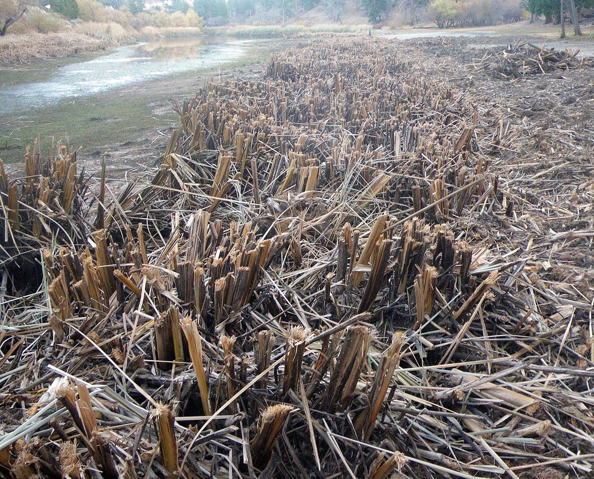
Now the cattail cleanup begins!


Mallards.


Devil's Horn moon.


My picnic view (from inside the van).


Monday, November 9, 2009

Still Going

I've been working on the post for the second day of the Sierra backpack, but unfortunately DS decided to share a cold with me. Then, I received news that a close family member had tragically passed away. So working on the trail report ground to a sudden halt as my life became surreal as I tried to absorb the shock.

This has been a bad year for losing people for me, so I feel doubly blessed to still be here myself, still raising my family.
While I was on the road traveling home from the funeral---a long slur of time, miles, and decades---I was treated to the beautiful sight of Mt. Shasta in the morning sunlight.

It reminded me that I'd like to hike it; maybe not to the summit, but at least see how far I can make it before ice and snow turn me back. I'll do SOME ice and snow, as on our Mt. Whitney trip; but I just can't do the real stuff anymore.


Life is still good, and I am still blessed. May God bless my family and friends.


Take the highway.